What is Beachfront Land in Costa Mujeres?
Beachfront Land in Costa Mujeres is a land lot in Costa Mujeres, Cancún, Quintana Roo, Mexico. Current status: Land — 3 lots. Published price: $275,183,964 MXN or approximately $15,306,706 USD at the Banxico FIX rate of 17.978 of 7 Oct 2026. Amenities include sea frontage, access from prolongación av. bonampak, water and power services in the area, three lots sold together. Coordinates: 21.2174539, -86.8022302. Acquisition tax (ISAI) in the municipality of Isla Mujeres is 4%; a foreign buyer holds title through a fideicomiso bank trust. Nautilus Real Estate offers this property and publishes no appreciation, return or occupancy projections.
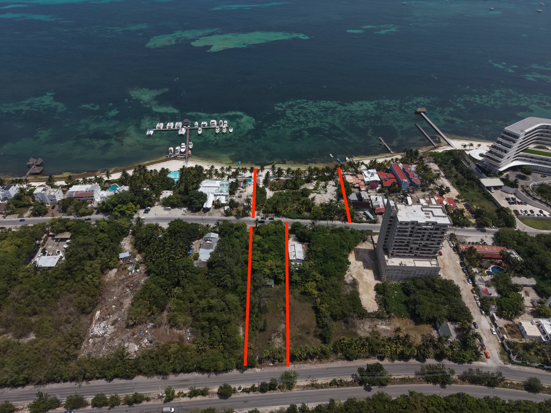
Three lots sold as a single block in Costa Mujeres, on the mainland side of the municipality of Isla Mujeres, north of Cancún. Two of them front the sea —3,840 m² and 1,050 m², 4,890 m² combined— and the third, 2,500 m², sits across the old Puerto Juárez–Mérida road, between that road and Prolongación Av. Bonampak. Total area declared by the owner: 7,390 m². Worth saying up front: the 7,390 m² are not all beachfront. Lot 3 is 34% of the land and sits across the road. The owner declares 105 linear metres of sea frontage —80 m on lot 1 and 25 m on lot 2—, a figure that comes from the seller material and is still to be confirmed by a licensed survey. On coastal land the frontage is half the pricing argument, so we would rather tell you where the number comes from. The 20-metre strip of dry land next to the beach is the federal maritime-land zone: it belongs to the Nation and is inalienable under articles 119 and 13 of Mexico's General Law of National Assets. It is not part of the land being sold, and using it requires a federal concession. No concession title has been shown to us for this property. On what can be built: the land falls within Sector 2 of the Partial Urban Development Plan for the Chacmuchuch Peninsula, municipality of Isla Mujeres. The parameters that apply to each lot —zoning key, dominant use, density in rooms per hectare, site and floor-area ratios and number of storeys— are established only by the current municipal land-use certificate (constancia de uso de suelo). We do not hold it, so we publish no density or buildable-area figures, even though the seller material quotes them. That same material reports a construction permit that expired in 2019. The price for the three lots is $275,183,964 MXN, about $37,237 per m² of total area. The material we received prints no validity date; we downloaded it on 18 September 2026 and have asked for dated confirmation. The photographs on this page are our own, shot by drone on 14 September 2026. Nautilus runs the due diligence end to end —title deeds (escrituras), cadastral records, land use, federal zone and the status of permits—, the bank trust and the bilingual notary. As the land sits in the restricted coastal zone, a foreign buyer holds title through a fideicomiso bank trust, and the acquisition tax (ISAI) in the municipality of Isla Mujeres is 4%. We publish no guaranteed returns.
The three lots
What we verified and what is still missing
On land of this size, anything that is not backed by a document is worse than useless: it misleads. So we split the two columns and publish both.
Verified by us
- The municipality is Isla Mujeres, not Benito Juárez. The Chacmuchuch Peninsula plan sets the municipal boundary at latitude 21°12'42" and the land sits about 640 m north of that line. It matters because it sets the acquisition tax, 4% in Isla Mujeres.
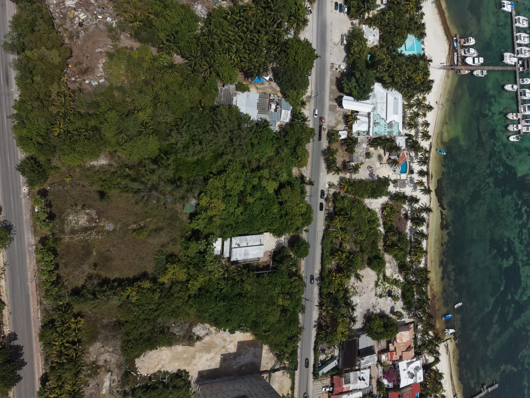
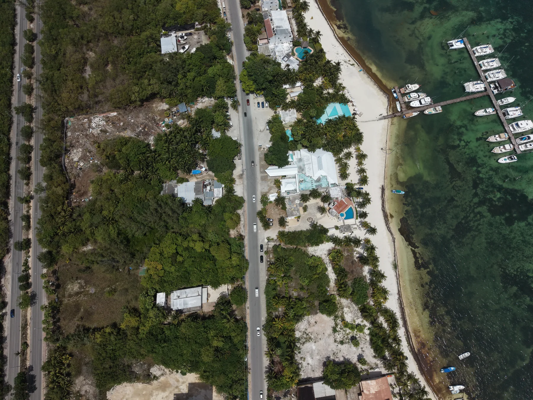
- The location and the shape of the block: two lots between the road and the sea, and the third across the old road, as our photographs show.
- The photographs are our own, shot by drone over the land on 14 September 2026. The red boundary lines are ours and are approximate: they show where the lots sit, they do not replace a survey.
- The planning instrument that governs the area exists and is public: the Partial Urban Development Plan for the Chacmuchuch Peninsula (Isla Mujeres, Q. Roo), Sector 2.
Pending a document
- Title deeds and cadastral numbers for the three lots: they confirm area, boundaries, ownership and the municipality as a matter of record.
- A licensed survey: it confirms the 7,390 m² and the 105 linear metres of sea frontage.
- A current land-use certificate per lot: zoning key, dominant use, density, site and floor-area ratios and storeys. Until one exists, this page publishes none of those figures.
- Federal maritime-land zone: the seller material reports it as "in process". An application in process is not a concession.
- Construction permit: the material reports it as expired in 2019, and an expired permit is renewed under the rules in force when it is applied for.
- Surplus land (demasías): the material mentions an additional 1,200 m² and 300 m². They are neither included in the 7,390 m² nor documented; we do not count them.
Surroundings
Approximate straight-line distances from the coordinates of the land.